WVEL Weather Watch:
The National Weather Service of Lincoln, IL has issued a Winter Weather Advisory for the WVEL listening area going on right now until 12noon CST Friday, February 22nd.
-Timing: Snow is expected to spread into areas late afternoon until later tonight. Some sleet may mix in at times in the first couple of hours of precipitation. The heaviest precipitation is expected between now (after 5pm) and 12midnight. After 12midnight, the snow may mix with or change to freezing drizzle.
-Accumulations: 4-7 inches of snow are likely; with higher totals west of the Illinois River. Any of these precipitation totals may be locally higher due to isolated thunderstorms embedded withing this storm this evening.
-Winds: East winds of 15 & 20 mph will gust to near 30 mph at times. This will create areas of blowing and drifting snow.
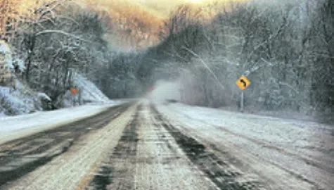
-Impacts: Conditions will deteriorate rapidly once the snow begins. Travel will become hazardous due to poor visibility and roads becomes quickly snow covered and icy. The potential for some freezing drizzle late tonight will only make driving conditions even more hazardous.
-Precautionary/Preparedness Actions: A winter weather advisory means that periods of snow, sleet, and/or freezing rain will cause travel difficulties. Be prepared for slippery roads and limited visiilities and use caution while driving.
Remember to keep it locked in to AM 1140 WVEL or www.wvel.com for more information. Stay safe & warm!